Google Earth Graph
Advertisement
Earth Addresser v.1.0
Earth Addresser takes the addresses from your Address Book and writes them to a 'KML' file which Google Earth can open to display your friends' places right on the map.
Advertisement
Analytics to Earth v.1.0
View your Analytics Georeports on a 3D Google Earth Globe in the integrated browser (which utilizes the Google Earth Internet-Plugin) or export your data to a .
UTrekGE v.1.2
Generate an up-down graph for a path in KML file of Google Earth.
GPSMaster.NET v.1 7
GPSMaster.NET can best be described as a mixture of Google Earth, World Wind, SeeYou, OziExplorer and Garmin Mapsource. GPSMaster.
RoboGEO
Geocode photos (including RAW) from a GPS. Stamp the images or write (lossless) to the EXIF headers. Create web pages using Google Maps, export KML/KMZ files to Google Earth, upload to Flickr, export shapefiles (SHP) or AutoCAD DXF files. Supports Garmin
Panorado Flyer
Panorado Flyer is a small, yet very useful tool for linking JPEG image files to the location where the picture was taken, using precise geographical coordinates. It can be lauched from the Windows Explorer's context menu. The coordinates of the place
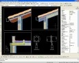
ProgeCAD Professional 2009 DWG CAD
AutoCAD functionality at less than tenth the cost! DWG DXF PDF read write. Similar icons, commands and interface. Raster image embedding, raster-to-vector software included. DWF and Google Earth KML publishing, IntelliCAD AutoLISP interpreter, ACIS 3D
KMLer v.3.0.1
KMLer is the ArcGIS extension for professional work with Google Earth. We recommend using this module and our free Typeconvert extension. KMLer Plus also supports additional functionality at description building.
GPicSync v.1 28
GPicSync automatically inserts location in your photos metadata so they can also be used with any 'geocode aware' application like Picasa/Google Earth, Flickr, loc.alize.us.
PlaceMarker v.0.0.7
Placemarker is a stand-alone application for pictures and icons generation in Google Earth. Placemarker lets you create a Google Earth placemark different than the standard placemarks available in the program.
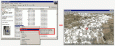
Gismaps Viewer v.1. 3. 3524
Gismaps Viewer is a GIS viewer that can be used for geospatial analysis and map production.